Glacier Edge Dynamics
Jarvis Ice Field Velocities
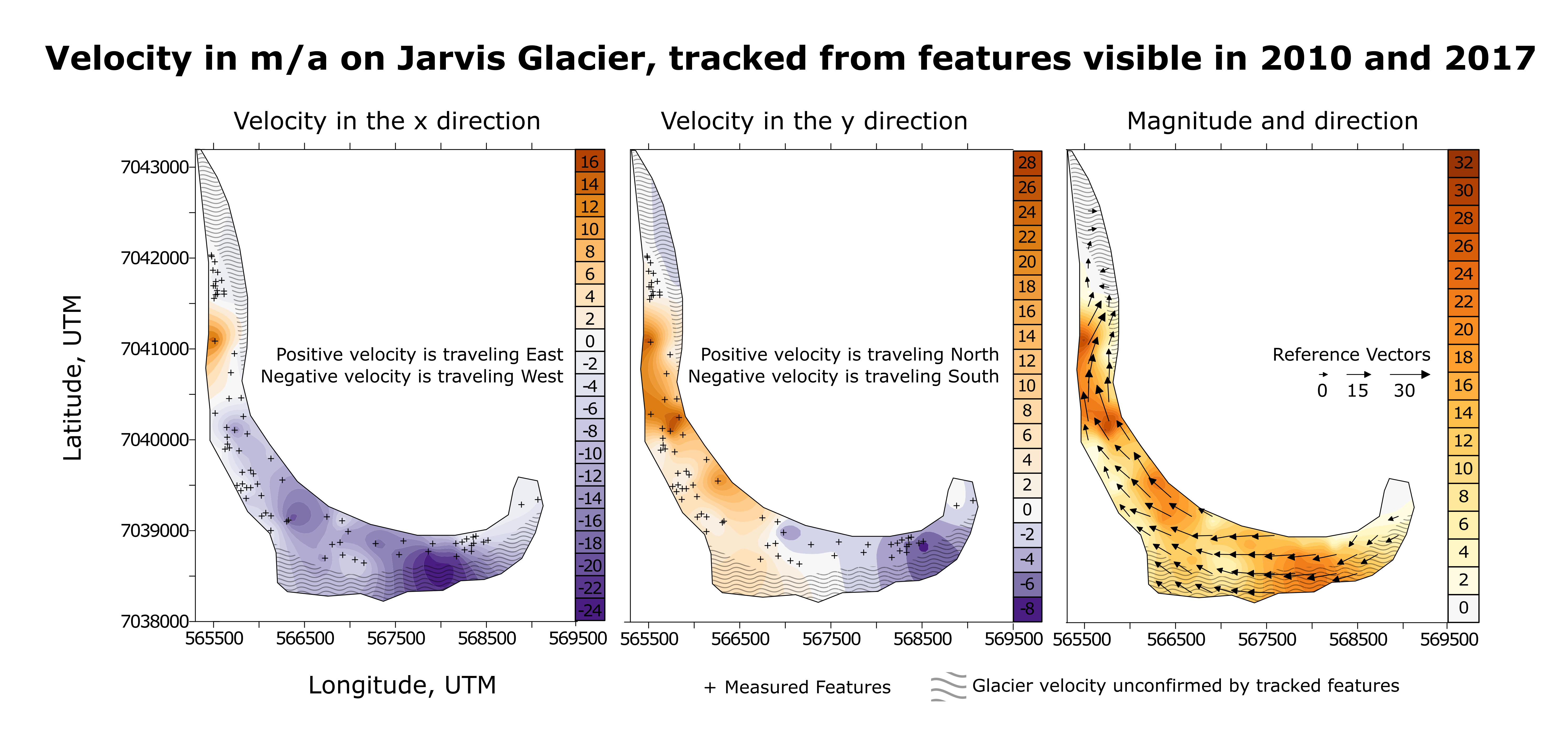
Satellite images for feature tracking were from Planet's RapidEye satellites. 77 features (dirt bands, boulders etc.) were identified in 2010 and reidentified in the 2017 image. The distance between those features divided by the time elapsed is the velocity. This velocity was extrapolated with Golden Software's Surfer.
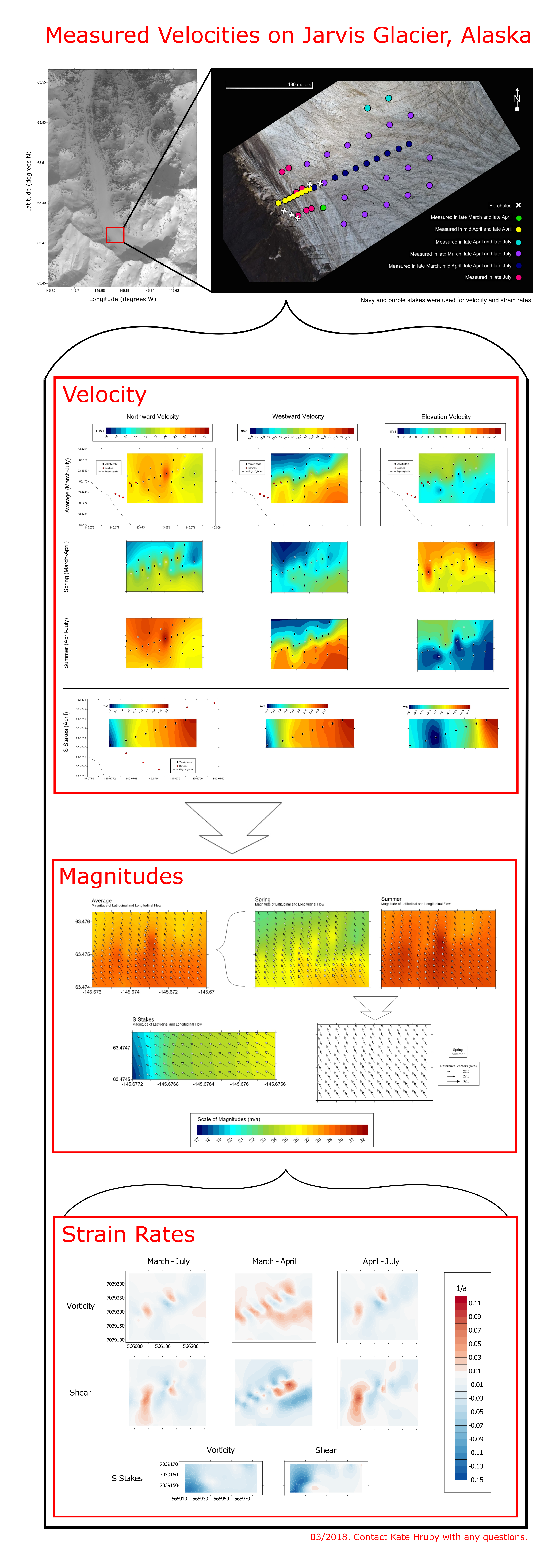
Jarvis Glacier is a mountain glacier located in the Alaska Range. It flows from south to north, travelling around a bend in the southern portion of the glacier. A field site was constructed in March 2017 where 44 velocity stakes were placed in a grid from the margin to the center of the ice's flow. Velocities from the purple, dark blue and yellow stakes in the first image were then extrapolated to fill the field site, as shown in the following plots. Vorticity and shear was calculated from those velocities using Golden Software's Surfer program. The satellite image of Jarvis is from Digital Globe in 2016, courtesy of Polar Geospatial Center.
Acknowledgements Satellite imagery used for feature tracking courtesy of Planet Team, Planet Application Program Interface: In Space for Life on Earth. Additional geospatial support for this work provided by the Polar Geospatial Center under NSF PLR awards 1043681 & 1559691. This project was financially sponsored by the NSF Office of Polar Programs grant #1503924.
Citations Satellite Imagery Copywrite 2016. DigitalGlobe, Inc.

