Difference between revisions of "Glacier Edge Dynamics"
(Created page with "800px 600px '''Acknowledgements''' Satellite imagery used for feature tracking courtesy of Planet Team, Planet Application P...") |
|||
| Line 1: | Line 1: | ||
| + | |||
| + | |||
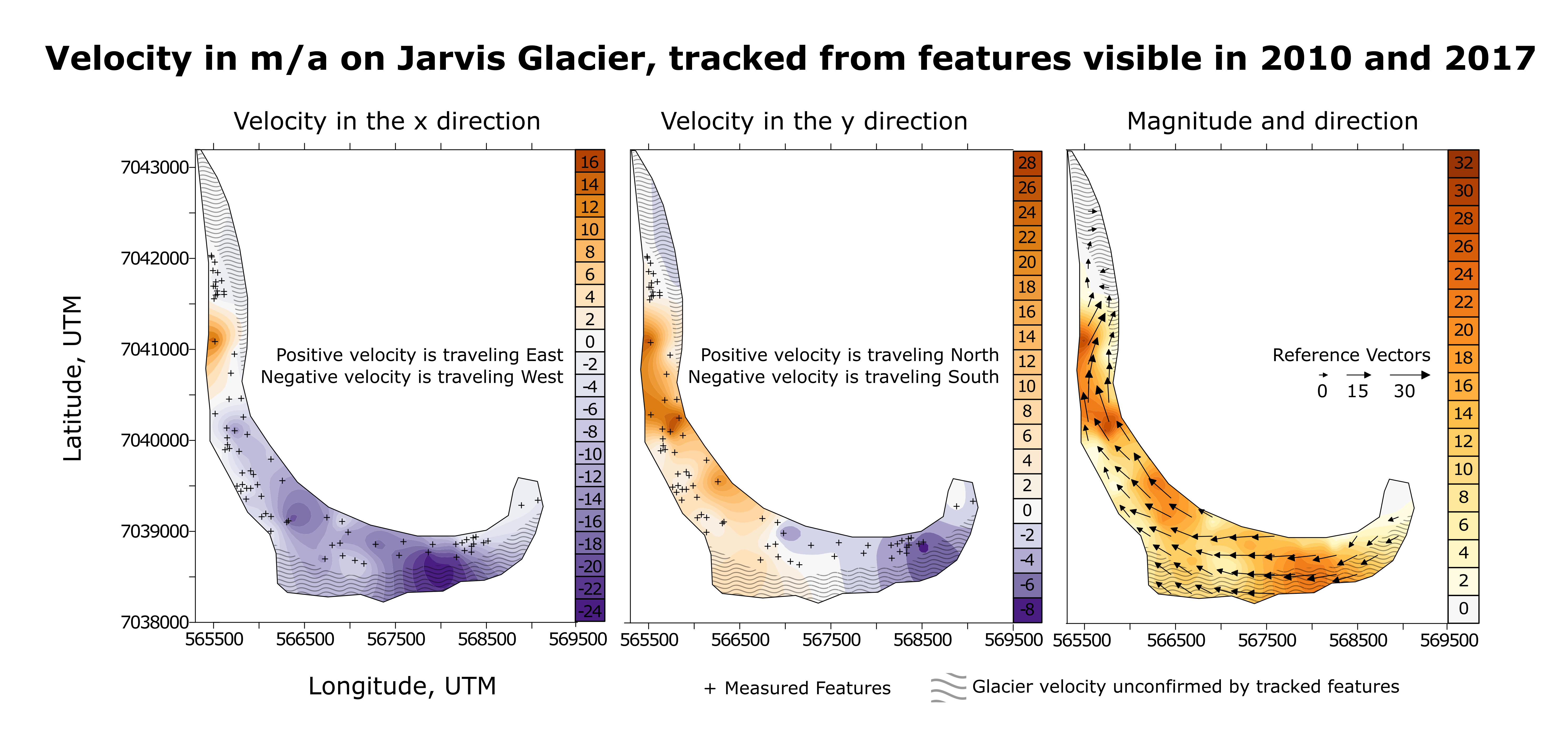
[[File:Jarvisvel2.png|800px]] | [[File:Jarvisvel2.png|800px]] | ||
| − | [[File:Jarvisvel1.png| | + | |
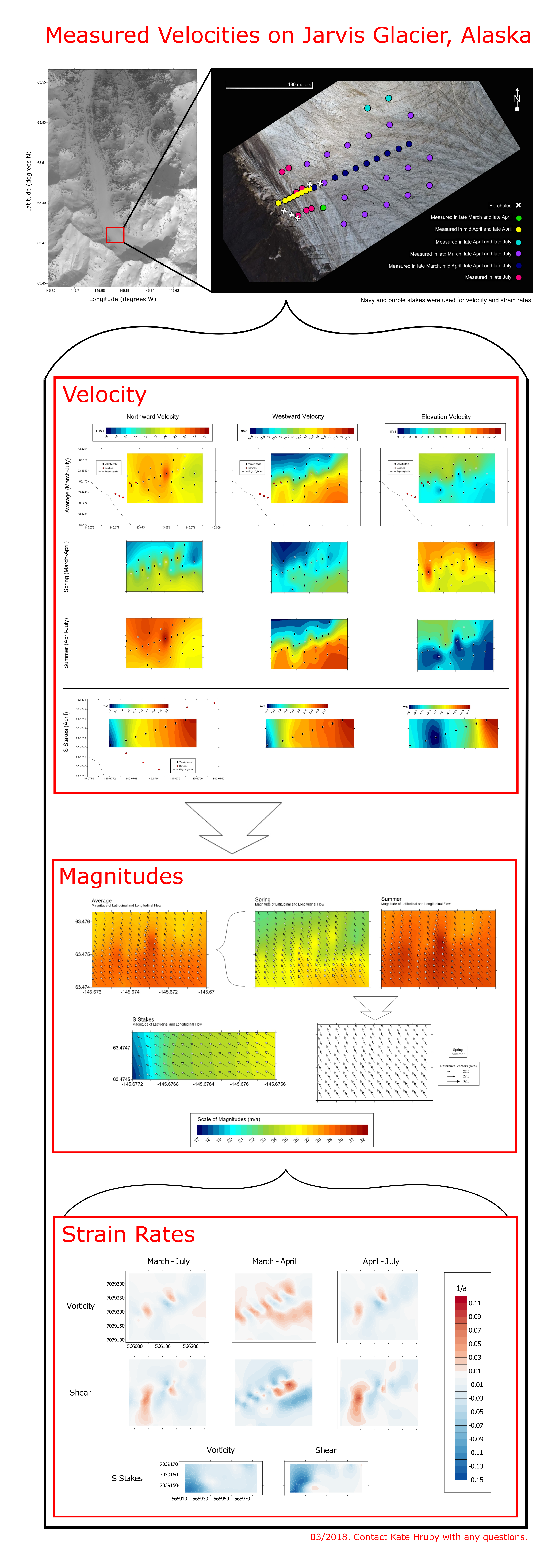
| + | [[File:Jarvisvel1.png|700px]] | ||
Revision as of 13:46, 19 March 2018
Acknowledgements
Satellite imagery used for feature tracking courtesy of Planet Team,
Planet Application Program
Interface: In
Space for Life on Earth.
Additional geospatial support for this work provided by the Polar Geospatial Center under NSF PLR
awards 1043681 & 1559691.
This project was financially sponsored by the NSF Office of Polar Programs grant #1503924.
Citations Satellite Imagery Copywrite 2016. DigitalGlobe, Inc.

