Difference between revisions of "Topographic Anisotropy Figure 9"
(Created page with "'''Figure 9''': A) Anisotropy measured at single point near Southern Alps divide. Anisotropy measured up to maximum wavelength of 450 km. B) Anisotropy magnitude and C) orien...") |
|||
| Line 1: | Line 1: | ||
| + | [[File:Vario figures copy Page 09.png|center|500px]] | ||
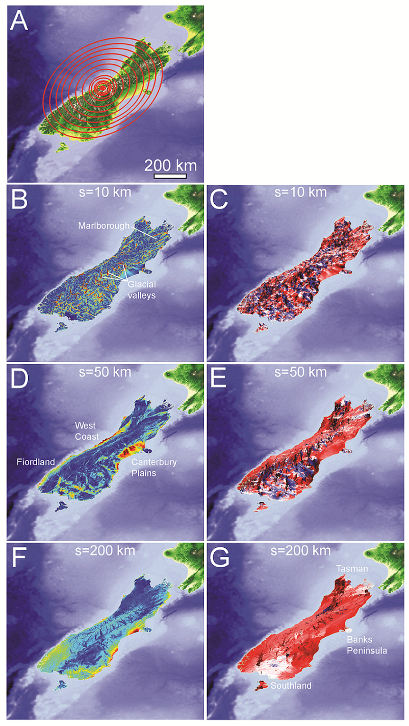
'''Figure 9''': A) Anisotropy measured at single point near Southern Alps divide. Anisotropy measured up to maximum wavelength of 450 km. B) Anisotropy magnitude and C) orientation map at 10 km, D) E) 50 km, and F) G) 200 km wavelength. | '''Figure 9''': A) Anisotropy measured at single point near Southern Alps divide. Anisotropy measured up to maximum wavelength of 450 km. B) Anisotropy magnitude and C) orientation map at 10 km, D) E) 50 km, and F) G) 200 km wavelength. | ||
